

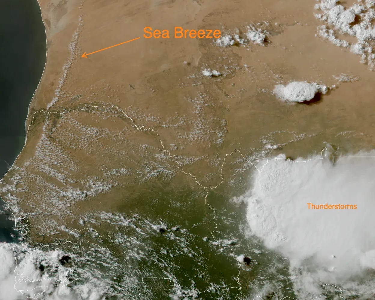
Strong thunderstorms form every day over Africa-especially in the Sahel region-but the one that was captured by the EUMETSAT MTG satellite on 20 July was quite special. The animation shows thunderstorms forming during the late afternoon over Mali and later moving over Senegal. Looking closely we can also see clouds associated with the land-sea breeze circulation moving inwards.
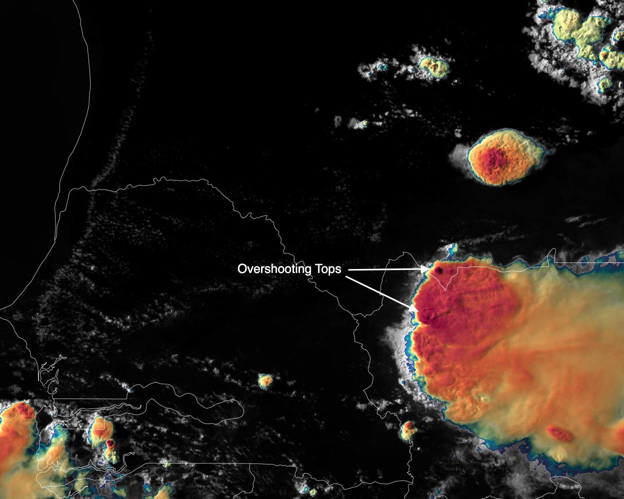
This is the same view but with the Sandwich product, which enhances the cloud tops associated with deep convection (red shading) and shows some overshooting tops.
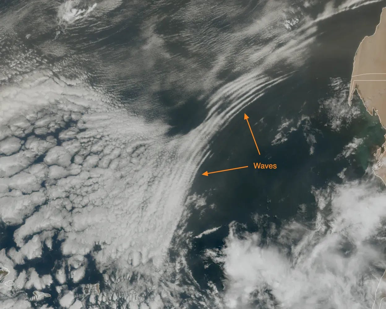
When the night sets in, some wave-like patterns can be clearly seen appearing in the upper-left quadrant. These are caused by the outflow boundary associated with the now dying thunderstorms moving over the ocean. In other words, the cold air “dumped” by the thunderstorm’s precipitation flux propagates away from it, bringing strong wind gusts that creates wave-like perturbation that can be seen once they encounter a cloud layer.
Here are the animations in (hopefully) original resolution on Vimeo.


